This article is more than
3 year old
Blizzard warnings. Whiteout watches. Avalanche threats. The alerts are startlingly unusual for Southern California, a region typically defined by its sunshine, palm trees and temperate weather.
But Los Angeles and other nearby counties are bracing for a snowstorm unlike any seen in decades — or possibly ever.
“This could be really substantial,” UCLA climate scientist Daniel Swain said. “In fact, it could be a historically significant snowfall for parts of the Southern California mountains. This well may be the largest single-event snowfall in some parts of Southern California since the 1980s. This is a big deal.”
The storm, which has already made a mess of conditions in some parts of Northern California, is expected to gain strength as it arrives in Southern California early Friday.
The “highly dynamic” system will likely bring heavy rain, strong winds, thunderstorms and potential localized flooding to areas in and around Los Angeles, Swain said. In the L.A. and Ventura county mountains, snow levels could be as low as 1,500 feet — roughly the elevation of the Hollywood sign, where residents reported that a wintry mix had already landed Thursday afternoon.
“It’s a very rare event,” said Jeff Zarrinnam, chairman of the Hollywood Sign Trust, who made a snowball beneath the world-renowned landmark.
Though the storm is unusual, it’s not the first time Southern California has seen snow.
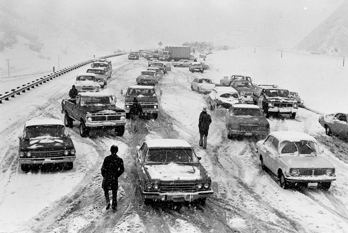
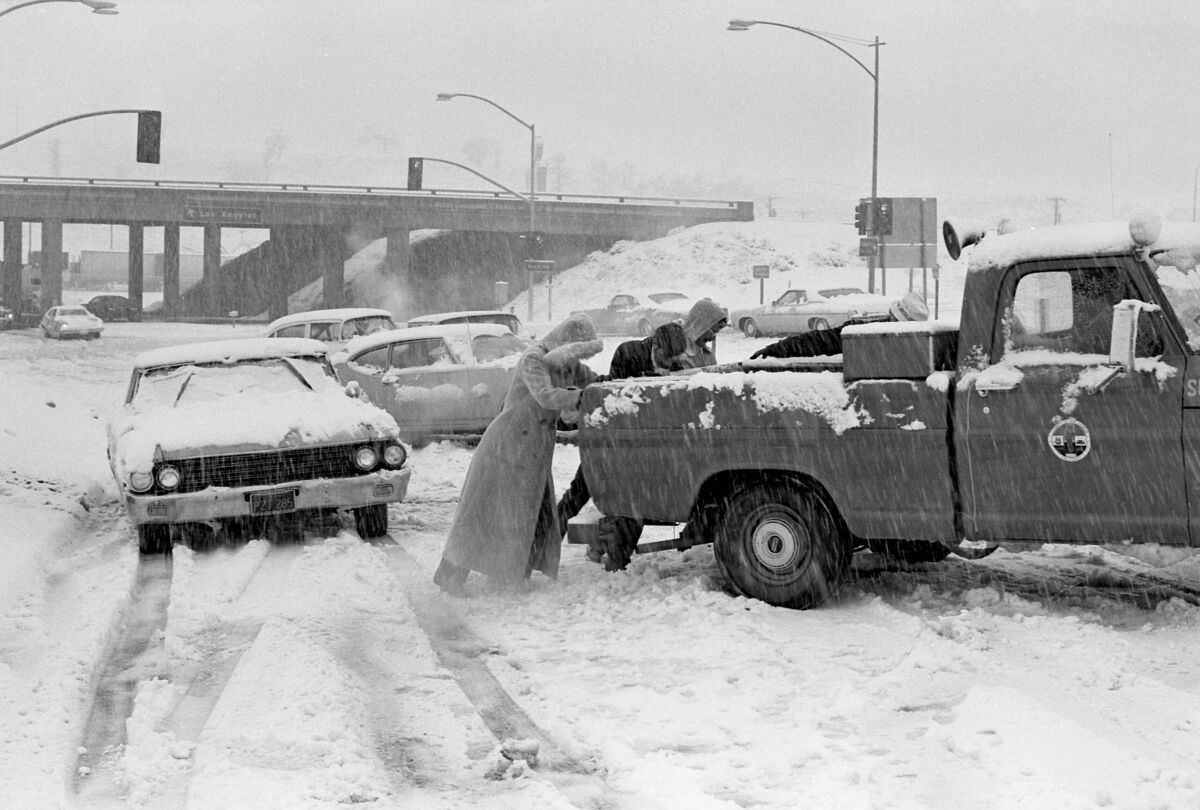
Similar wintry conditions occurred in 1989 — the first and only other time the weather service issued a blizzard warning in the L.A. area — back when Tom Bradley was L.A. mayor and gasoline sold for about $1 a gallon. That storm dropped up to 5 inches in parts of the San Fernando and Simi valleys, and snow was reported “from the hillsides of Malibu to the streets at Palm Springs,” The Times reported at the time.
Snow also made appearances in 2019, 2007, 1998, 1987 and 1974, according to Times archives. In 1962, heavy snow fell in the mountains and high deserts and dusted parts of downtown and West Los Angeles before melting quickly.
Perhaps the most famous snowstorm was in January 1949, when several inches piled up in the region over several days. Times articles from that time described 14 inches of snow on Ventura Boulevard near Woodland Hills, a foot in Laurel Canyon and light flurries around the L.A. Civic Center.
“The Times’ switchboard received numerous calls from residents in all parts of the city reporting what they described as winter scenes ‘just like back east,’” one story from 1949 read.

What makes the current system so noteworthy, however, are the potential snowfall totals in the mountains around Los Angeles, which could exceed 3 or 4 feet over a 48-hour period, or even reach as much as 8 feet on high mountain peaks. The forecast is so significant that the Mt. Baldy Resort, which most winters doesn’t get enough snow to operate all of its runs, has closed its slopes.
“A big storm system is in route to the area,” resort officials wrote in a post on Instagram. “Not only is it big, some are calling it a potential national record setter.”
Forecasters say nearly 100 inches of fresh powder could fall on Mt. Baldy and other high-elevation areas. Even places that don’t normally see snow should get some powder, including up to 12 inches at elevations between 2,500 and 4,000 feet, and up to 4 inches at elevations between 1,500 and 2,500 feet.
The National Weather Service has issued blizzard warnings from 4 a.m. Friday to 4 p.m. Saturday in the Ventura, Los Angeles and San Bernardino county mountains, where heavy snow, strong wind gusts and “near zero visibility” are likely. A flood watch is also in effect in portions of Santa Barbara and Los Angeles until Saturday, with peak rain rates of 0.75 of an inch per hour possible.
“What is really kind of astonishing are the snow totals that are projected for the Southern California mountains and the southern Sierra Nevada,” Swain said.
Climatologist William Patzert said several factors must come together for such a rare occurrence in Los Angeles.
Though many winter storms travel down the spine of the Sierra and lose their moisture by the time they reach Southern California, the incoming low-pressure system is moving down off the coast of Canada, where it is loading up with Pacific moisture, he said.
The cold temperatures and strong, moist winds coming off the Pacific “are the ingredients for blizzards for California,” Patzert said.
He said this winter’s unusual pattern of “extreme volatility” could be linked to swings in the jet stream that started around December. The jet stream is the air current in the upper level of the atmosphere that guides weather systems across the globe.
The National Weather Service is advising residents to avoid travel during the storm and to be prepared for potential power outages, downed trees and other hazards, including an increased threat of avalanches.
Though some Angelenos may be tempted to travel to mountain areas to seek out the snow, Swain warned that it’s probably best to stay home.
“This is not a weekend you’re going to be able to go up and ski — no one is going to be able to get in or out, potentially for days,” he said. “If you live up there, be prepared for a phenomenal amount of snow. And if you don’t live up there, realize you’re not going to be getting up there.”
Patzert noted that while the storms could pose immediate hazards, they will probably be beneficial for drought recovery, after several years of prolonged dryness.
“In the short term it’s dangerous, but in the long term, we really needed this,” Patzert said.
“February,” he added, “came in like a lamb, but it’s going out like a lion.”
Times staff writer Terry Castleman and researchers Scott Wilson and Cary Schneider contributed to this report.