This article is more than
7 year old
N-n-not to put too f-f-fine a point on it, but Canada is c-c-c-cold right now.
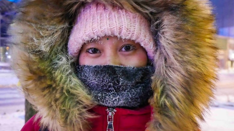
From central Saskatchewan to eastern Quebec and through much of Nunavut, extreme cold warnings from Environment Canada advise people to be mindful of the "extremely dangerous" conditions, frostbite and the safety of their pets.
The bitter cold is the result of a split in the polar vortex that has allowed temperatures to plunge much farther south in North America than normal.
"Bitterly cold arctic air has moved into southern Ontario overnight," the warning for Toronto says. "Overnight low temperatures near minus 20 degrees Celsius combined with strong southwest winds have resulted in wind-chill values in the range of minus 30 to minus 35."
Windsor, Ont., is having its coldest Jan. 30 on record, with a low of –21.7 C Wednesday at 7 a.m. ET. The previous record was –20.6 C, set in 1951.
And those are two of the warmer spots under warning.
At 7 a.m. CT, it was –40 C in Winnipeg and felt like –50 with the wind chill. Dozens of schools in the province were closed due to the extreme cold, and CAA Manitoba sent out a service alert explaining it was temporarily stopping house calls and focusing on people who may be in an unsafe situation, such as at the side of a road.
In Saskatchewan, Manitoba and northern Ontario, forecasters are warning of wind-chill values of –50 or –55, and in parts of Nunavut –60.
"Wind-chill values of this magnitude are relatively rare for this region and are extremely dangerous," the warning in several northern Ontario regions says.
Extreme cold can cause hypothermia and frostbite, and the warnings tell people to watch for symptoms related to the conditions: shortness of breath, chest pain, muscle pain and weakness, numbness, and colour change in fingers and toes. The weather agency also says that frostbite can occur within minutes.
The warnings also offer a word of caution about pets: "If it's too cold for you to stay outside, it's too cold for your pet to stay outside."
In most of the affected areas, the weather isn't likely to warm up — relatively — until Friday or Saturday.
"We have this air — you know, the infamous polar vortex, if you will — or this arctic air that has been just sitting," Marie-Eve Giguere, a warning-preparedness meteorologist with Environment Canada, told CBC Thunder Bay on Tuesday.
"It always wiggles around the North Pole in the winter, and now it just so happens that it digs over Ontario.
"It's not going anywhere," she continued.
"In meteorology, we say we need a kicker [to displace it]. The weather pattern is sort of locked in a position, and then it just spins and spins and spins over the same area."
The same arctic deep freeze has also enveloped the U.S. Midwest, forcing widespread closure of schools, businesses and government offices, and prompting the U.S. Postal Service to take the rare step of suspending mail delivery to a wide swath of the region.
Extreme weather conditions prompted Amtrak to cancel all trains into and out of Chicago on Wednesday and most services to or from Chicago on Thursday.
Many normal activities are shutting down and residents are huddled inside as the U.S. National Weather Service forecast plunging temperatures from one of the coldest air masses in years.

Officials throughout the region are focused on protecting vulnerable people from the cold, including the homeless, seniors and those living in substandard housing.
At least four deaths in the U.S. have been linked to the weather system.
The cold is attributed to a sudden warming far above the North Pole. A blast of warm air from misplaced Moroccan heat last month made the normally super chilly air temperatures above the North Pole rapidly increase. That split the polar vortex into pieces, which then started to wander, said Judah Cohen, a winter storm expert for Atmospheric Environmental Research.
One of those polar vortex pieces is responsible for the frigid temperatures.
With files from CBC Thunder Bay and The Associated Press