Google Maps is using giant virtual arrows to stop people from getting lost
Feb 12, 2019
Published Feb 12, 2019, 10:11 AM ET
For now, Google is trying to keep these images simple. An earlier prototype of the AR feature displayed fireworks when a user approached their destination in Google Maps, said Gorecki. The team decided that wasn't a good idea.
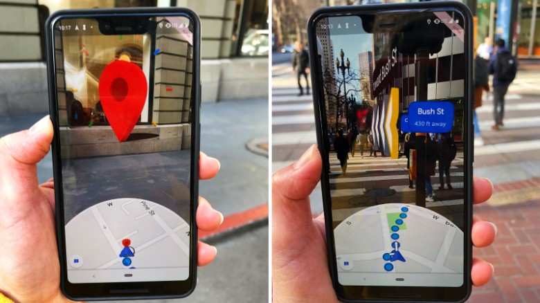
San Francisco (CNN Business) - Google Maps wants to make it easier for people find their way in busy urban spaces, and it thinks large cartoon arrows can help.
On Monday, Google Maps began letting some users test a new augmented-reality feature in its mobile app that shows graphics — such as highlighted arrows and street names floating in midair — over a live view from their camera on their smartphone screens. It is meant to help them navigate city streets.
Google's Rachel Inman, who works on user-experience for the new feature, said the company hopes to make it simpler to go between the two-dimensional map on your phone and the three-dimensional world around you.
"We've all had the experience of coming up from the subway and walking a half block or a full block in the wrong direction and being really annoyed when we have to turn around and walk the way we were supposed to go in the first place," she told CNN Business at a real-life demonstration of the feature in San Francisco on Monday.
Google is testing new AR features for its Maps app.