This article is more than
3 year old
Hurricane Fiona has the potential to be a severe storm for parts of Eastern Canada this weekend.
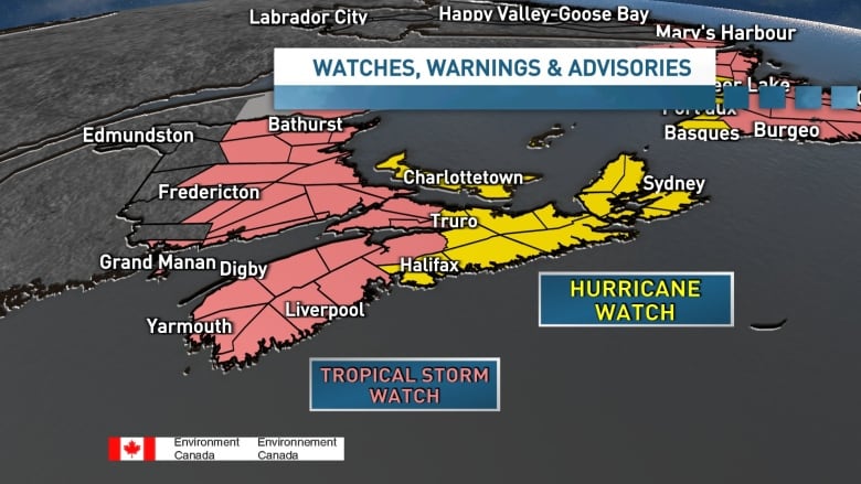
The hurricane will track northward and into the Maritimes late Friday and Saturday as it transitions to a post-tropical storm. That post-tropical transition does not mean the storm will be weaker, but its structure will change. It will grow in scale and cover even more territory.
Bob Robichaud, warning preparedness meteorologist with Environment Canada, said in a briefing Thursday that Hurricane Fiona is an "extremely strong and dangerous storm."
While the "cone of uncertainty" is still quite large, it's narrowing each day. Forecast models continue to project landfall over Cape Breton or the eastern mainland of Nova Scotia.

The storm was about 1,800 kilometres southwest of Halifax with an intensity of 215 km/h as of Thursday afternoon.
While some uncertainty remains with the track and other details, the potential impacts are becoming more clear.
Rain will arrive well ahead of Fiona. A cold front moving in from the west will bring its own rain on through Thursday and into Friday and then begin to tap into moisture from Fiona.