Disruptive winter storm to blast Midwest with blizzard conditions and threaten Southeast with tornadoes and floods
A vast and disruptive storm is set to whip up miserable morning commutes as it blasts the Midwest with heavy snow and blizzard conditions while also blanketing the Southeast with damaging winds, rain and possible tornadoes – conditions that are expected to expand into the Northeast later Tuesday.
Live updates: Eastern US winter storm and severe weather
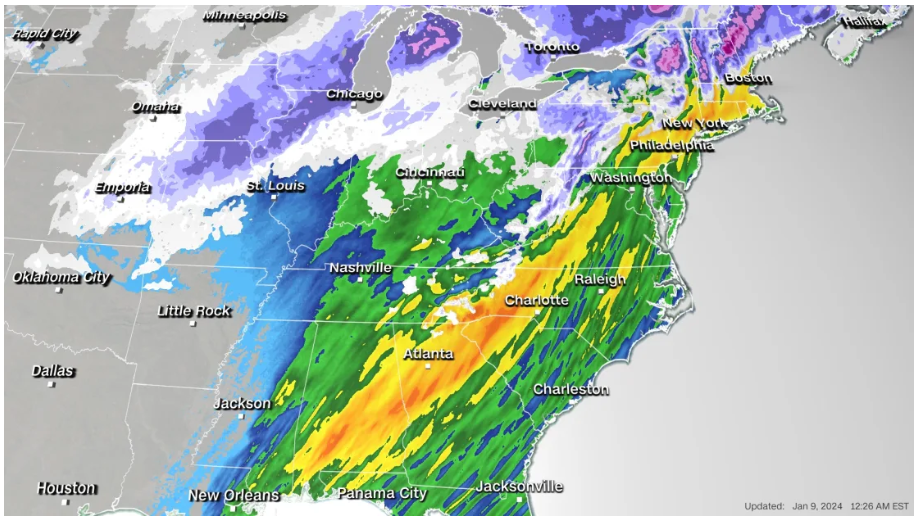
More than 40 million people are under severe storm threat on Tuesday with weather alerts stretching more than 2,000 miles from New Mexico to Maine, according to the Storm Prediction Center.
The system has already hit the South with hail storms, significant flooding and tornado threats and unleashed perilous blizzard conditions in parts of the central US, shutting down several highways and stranding drivers in frigid temperatures.
In the storm’s path? Bookmark CNN’s lite site for fast connectivity on low bandwidth.
Amid severe blizzard conditions in Kansas on Monday, the state highway patrol said it had responded to more than 300 calls for help and nearly 70 crashes. But whiteout conditions were making it difficult to see and authorities were having difficulty with rescues, one trooper said on social media.
Widespread power outages are expected Tuesday as strong winds threaten to topple power poles and down trees in areas where the ground has been saturated by rain.
More than 150,000 homes and businesses in six states are already experiencing outages, mainly in Texas, Alabama and Washington, according to tracker poweroutage.us.
Here’s what to expect Tuesday:
• Tornadoes threaten Southeast: More than 11 million people from the Florida Panhandle to North Carolina are at risk of seeing tornadoes, including some strong ones with winds over 110 mph. That includes metropolitan areas such as Jacksonville, Florida and Charleston South Carolina. A tornado watch is also in effect until 8 a.m. ET for southern parts of Louisiana, Mississippi and Alabama and the western Florida Panhandle.
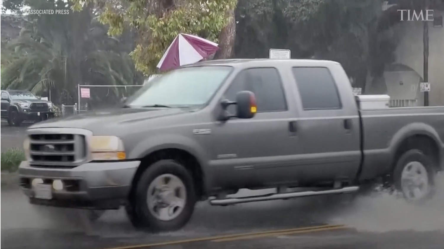
• Rain could trigger damaging flooding: Flooding is a significant concern in areas where heavy rainfall is soaking already saturated ground. Several major metropolitan areas along the East Coast could see flooding, including Atlanta, Georgia, Washington, DC and New York City, where rainfall of 2-4 inches is possible.
• Strong winds threaten widespread power outages: Gusty winds could also cause widespread power outages Tuesday as more than half the US population – in areas stretching from the South to the Northeast – are under wind alerts.
• Treacherous blizzard conditions shift east: Blizzard warnings spread from New Mexico to Nebraska through Tuesday morning as the threat shifts from the Plains to the Midwest. Another 2-6 inches of snowfall are possible in the area, along with winds of up to 70 mph.
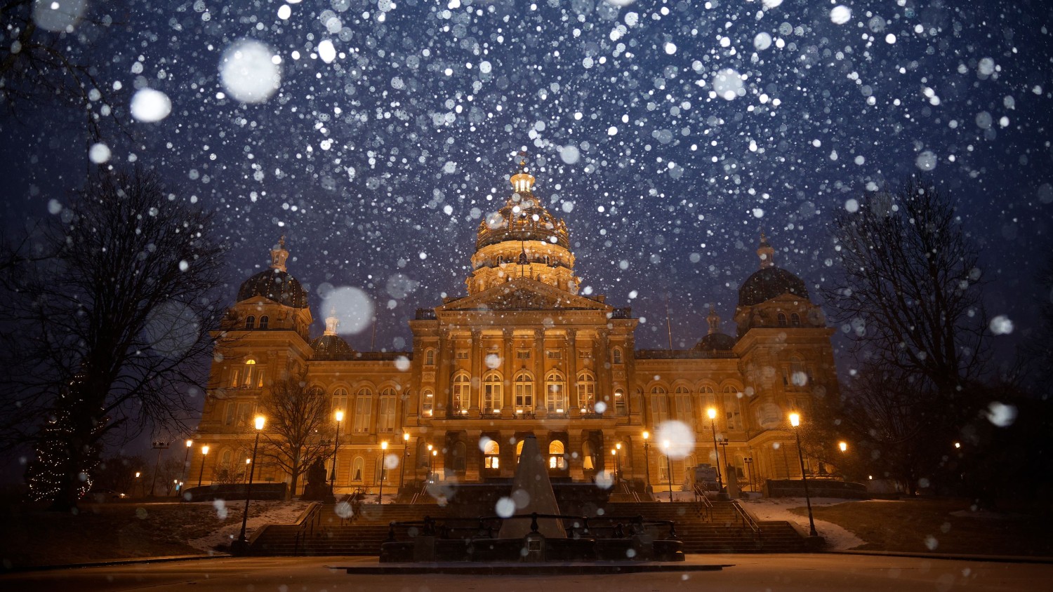
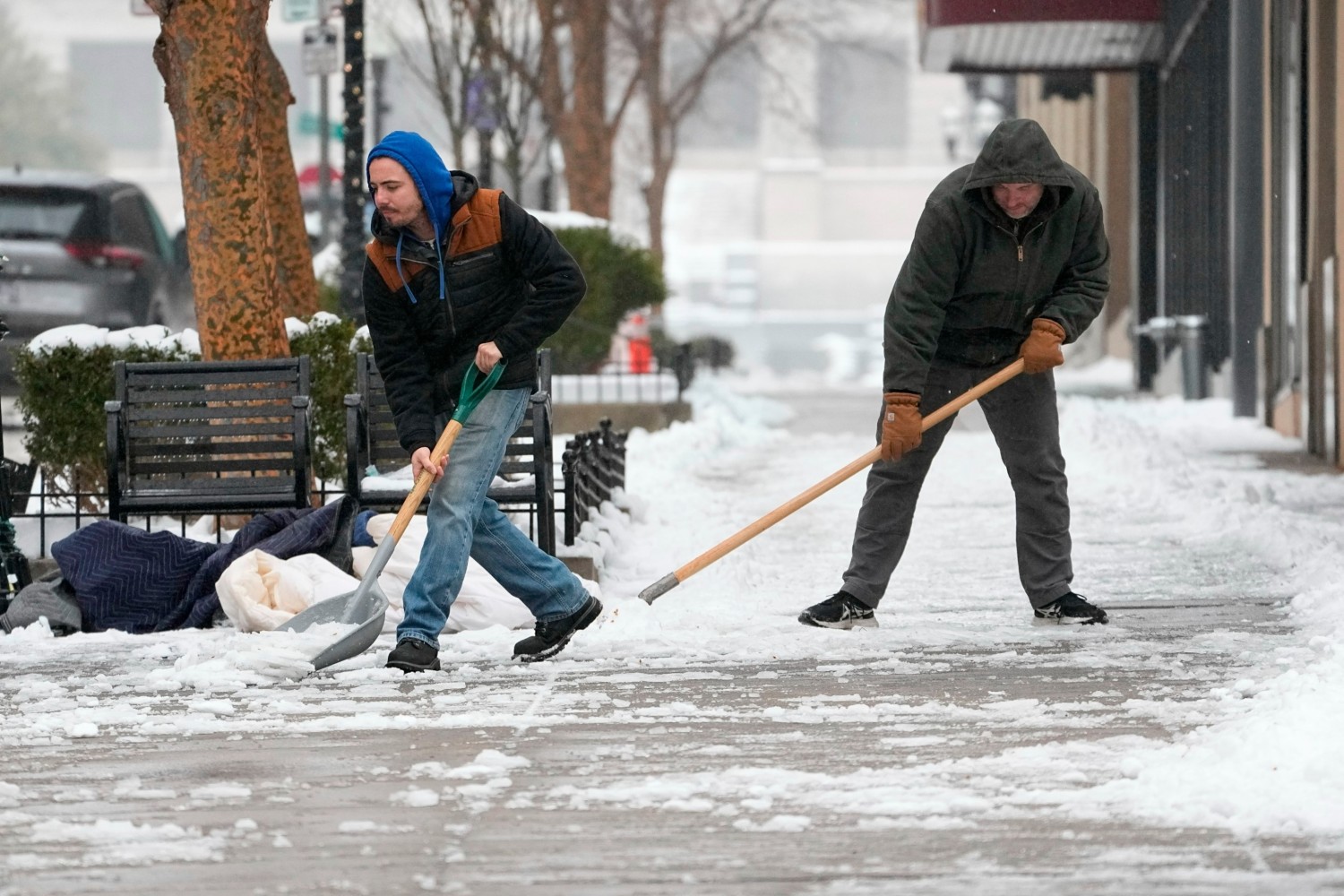
• Up to a foot of snow possible from central US to Northeast: Winter storm alerts are in effect for areas of eastern Kansas, Nebraska and eastern Wisconsin, as well as interior parts of the Northeast and New England. Widespread snowfall between 6-12 inches is possible and some areas could see even more. The snowfall will begin to let up in the central US on Tuesday and in the Midwest, Great Lakes and Northeast on Wednesday.
Major cities in the storm’s path are bracing for impact.
New York Gov. Kathy Hochul warned the storm could be “life threatening” and noted the dangerous combination of the coming rainfall on top of the snow already blanketing the ground in the state, which saw up to 18 inches of snow in some areas. She said the Hudson Valley has a 70% chance of flash-flooding.
“We were able to handle this weekend’s snow event very well, but tomorrow’s storm is different and we’re taking it very seriously,” Hochul said Monday evening. The state is prepositioning more than 8,000 utility workers, four water rescue teams and dozens of massive generators, she said.
The coming storm has also prompted school and government office closures in several states on Tuesday, including North Carolina and Florida, where more than 30 K-12 school districts have canceled classes.
The system will dissipate by the week’s end, but relief is still not in sight for many across the eastern US. Another storm could follow on Friday and into the weekend, impacting many of the same areas.
Blizzard conditions trap travelers
Blizzard conditions buried parts of the southern Plains and central US under heavy snow and blistering winds on Monday, creating perilous road conditions that trapped drivers, forced several highway closures and at times made rescues near-impossible.
“Visibilities may drop below 1/4 mile due to falling and blowing snow. Whiteout conditions are expected and will make travel treacherous and potentially life-threatening,” the National Weather Service warned Monday.
After Kansas Highway Patrol troopers responded to hundreds of calls for help on Monday, a spokesperson warned that increasingly severe conditions may prevent authorities from being able to rescue motorists.
“Please stay home,” the trooper said on social media. “We will not be able to rescue you if you get stuck because we are having trouble getting around.”
Parts of the state’s Interstate 70 were also closed amid storm conditions and remained shut down overnight, the Kansas Department of Transportation said Monday evening.
Further west in New Mexico, 50 drivers were stranded amid blizzard conditions on Highway 56 in northeastern Union County and had to be dug out, the local sheriff’s office said Monday.
Inland and coastal flooding pose significant risks
Flooding is a serious concern as the storm’s strong winds blow water onshore as communities are inundated with rain.
“Widespread and potentially significant river and flash flooding are likely from the central Gulf Coast through much of the Eastern U.S. early this week,” the Weather Prediction Center said Monday. “Powerful onshore winds will lead to widespread coastal flooding along the eastern Gulf Coast and much of the East Coast.”
There’s also a significant concern of flooding in the Northeast with this next wave of rain coming right after the first snowstorm dropped more than half a foot of snow in multiple Northeast states.
New York City issued a travel advisory and flood watch that’s set to start Tuesday evening, warning of heavy rain, strong wind and the potential of coastal flooding.
“Let me be clear,” Hochul said in a Monday news briefing. “This will be an emergency, it will be serious and we’re urging all New Yorkers to exercise extreme caution at this time.”
Heavy rain will accelerate snowmelt and increase the amount of water running off into waterways, raising the ceiling on the flood potential in these areas.
CNN’s Dave Hennen, Mary Gilbert, Taylor Ward, Jennifer Feldman, Maria Sole Campinoti, Jennifer Henderson and Amanda Jackson contributed to this report.
Keywords


<p>The British singer/songwriter/DJ will perform at Warner Theatre on May 16.</p>
For Putin, Gaza is an endless gift
TikTok Ban Sparks Lawsuit Pitting National Security Concerns Against First Amendment Rights
Bombshell new theory on Titan sub disaster
Russia pounds Ukraine with biggest airstrikes in weeks
Woman'sCanadian citizenship revoked after 32 years amid 'error'
‘Orange turd’: Porn star’s swipe at Trump
WWE icon ruthlessly axed after 32 years
Justin Bieber announces huge personal news
Netflix edits out awkward Kim moment