This article is more than
1 year oldWhy Hurricane Hilary is so strange — and how it has impacted California

In a summer of extreme weather events, onetime Hurricane Hilary is yet another atypical occurrence — a storm that hit the West Coast of the United States on Sunday.
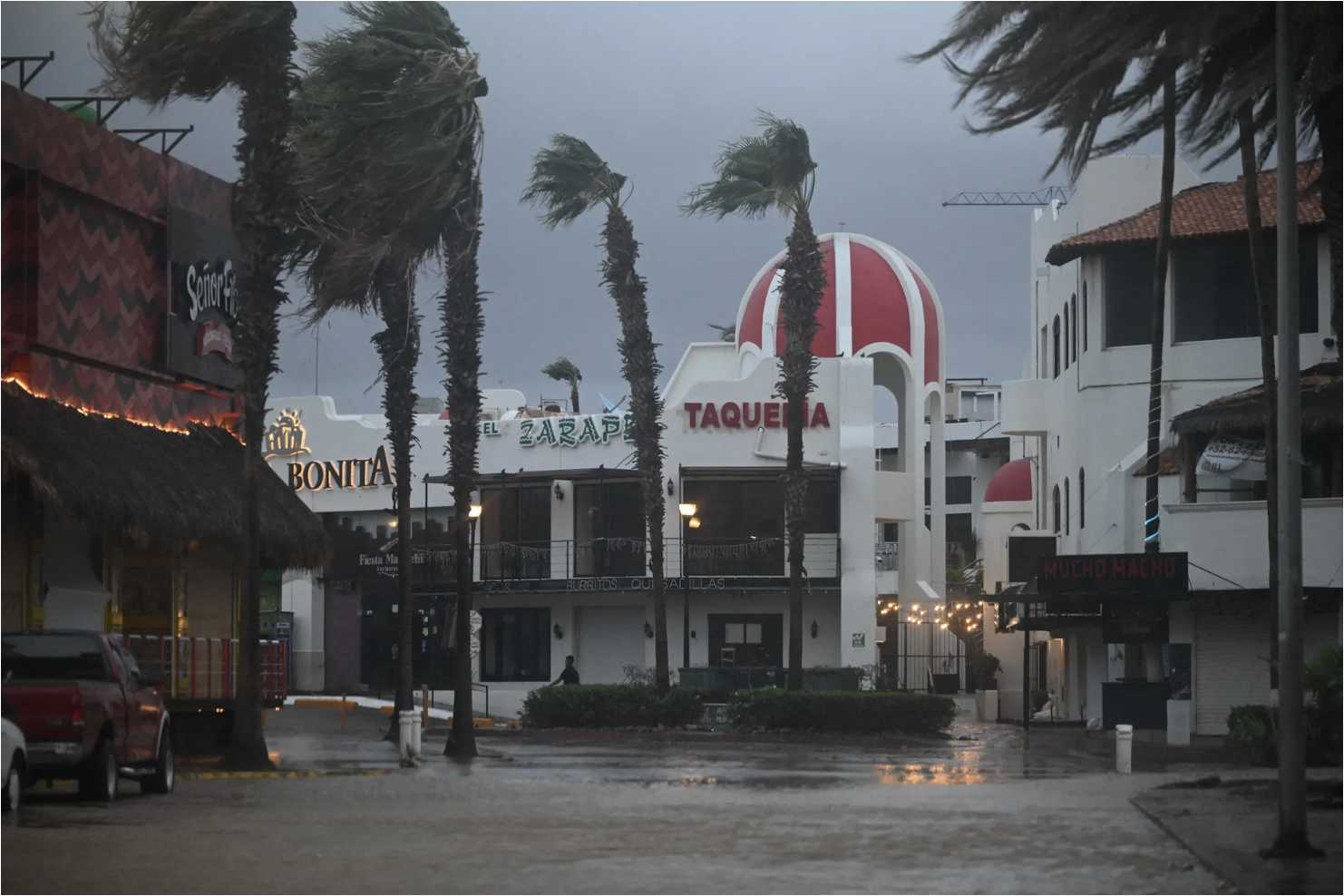
Hilary was downgraded from a Category 4 hurricane to a tropical storm before it made landfall in Mexico and then again to a post-tropical cyclone as of Monday. It has still brought maximum sustained winds of 60 mph and dangerous flash floods and rock and mudslides in Mexico and Southern California, leaving many without power and forced to evacuate. And it coincided with a 5.1 magnitude earthquake that hit north of Los Angeles Sunday, further rattling residents sheltering from the storm, though not resulting in any immediately reported injuries.
The storm is expected to bring further flash and urban flooding as it moves east. The National Weather Service’s Weather Prediction Center forecasted additional rainfall of 1 to 3 inches across parts of southeast California and southern Nevada Monday, as well as 1 to 5 inches of rain in parts of Oregon and Idaho through Tuesday morning. That would bring total rainfall from the storm up to 12 inches in some areas.
Hilary was the first tropical storm to hit California in more than 80 years. Though California has had hurricanes before, it’s extremely rare because cold water flows from Alaska typically make the Pacific coast an unsuitable environment for them. Hurricanes rely on water surface temperatures higher than 26 Celsius to form and grow powerful.
While people on the southeastern coast — particularly in Florida up through the Carolinas, and along the coast of the Gulf of Mexico — are likely well-versed in hurricane preparation, and live in states with storm-hardened infrastructure, that’s not so for Southern California and parts of the Southwest in the storm’s path.
California Gov. Gavin Newsom issued a press release Friday outlining the government’s preparation for the storm and urging Southern Californians to prepare themselves for “the wettest tropical cyclone in state history and the first-ever Tropical Storm Watch issued for California.”
California has already had an extremely wet year, though that’s unrelated to Hilary’s development and unusual path. Thirty-one atmospheric rivers hit California last winter and this spring, many of them quite strong. California’s atmospheric rivers provide much of the state’s precipitation, both as rain and as snowfall, which accumulates in high elevations as snowpack and melts in the warmer months.
But this year’s atmospheric rivers were severe in both intensity and duration, erasing some drought restrictions, but also causing devastating flooding and record-breaking snowfall.
They were also concentrated in California’s Central Coast and in Southern California, where Hilary also hit. “That’s where we’re really seeing a lot of our larger anomalies in terms of overall precipitation,” Chad Hecht, a research and operations meteorologist at the Center for Western Weather and Water Extremes at UC San Diego’s Scripps Institution of Oceanography, told the LA Times in April. “This year, the Central Coast saw four strong atmospheric rivers, where it typically averages less than two.”
[Related: This strange hurricane season may take a turn for the worse]
Though Hilary has now been downgraded and hasn’t had the power of many major hurricanes on the East and Gulf Coasts like Ida in 2021 and Ian in 2022, it has still proved destructive. Over the weekend, officials issued evacuation orders or warnings for parts of Los Angeles, Orange, Riverside, and San Bernardino Counties. Only some of those orders and warnings have since been lifted. As of Monday afternoon Pacific time, there were still more than 53,000 power outages in California, according to Poweroutage.us. And over 4,500 flights were delayed or canceled across the US Sunday as a result of the storm, according to FlightAware.
Hilary is unusual, but it doesn’t necessarily portend things to come
Hurricane Hilary’s path from the Pacific Ocean to Mexico and then northeast is strange. But it’s not unprecedented, as Paul Miller, an assistant professor at Louisiana State University’s Department of Oceanography and Coastal Sciences, told Vox in an interview.
“It’s certainly unusual,” Miller said. “There is historical precedent for it, though — it’s the kind of thing that has happened before. We can cite examples from our lifetime, but it is certainly unusual.”
Hurricane Nora impacted the American Southwest from the Pacific Ocean in 1997, as did Lester in 1992. Still, Miller points out, “We’re looking at 25 years since the last time we can point to a similar case.”
Though many unusual or extreme climate events are linked to climate change, there isn’t much to directly connect Hilary’s growth and path to the phenomenon. Higher water surface temperatures could account for some of the storm’s strength, but “There’s nothing about what’s happening right now to make me think that climate change is so dramatic that Southern California is now in the crosshairs of tropical systems,” Miller said.
The Eastern Pacific has its own hurricane season. It’s longer than the Atlantic hurricane season, starting on May 15 and ending on November 30. As the New York Times reported Saturday, it’s been an active season in the Eastern Pacific, though none of the storms have come as far west as Hilary has. “We typically don’t talk about storms in the Eastern Pacific as much because they tend to be less impactful to land,” though that’s not always the case, Miller said. Storms like Hurricane Dora, for example, have tracked much farther west, adding to the heavy winds which helped the deadly fire in Maui spread.
Hilary’s path has to do with two specific weather factors, Miller told Vox, including a heat dome over the central US. Though the warm temperatures and the heat dome Miller described didn’t cause Hilary to form — that happened thousands of miles away in the Eastern Pacific — it helped determine Hilary’s path.
High-pressure air moves clockwise, Miller explained, acting like a conveyor belt bringing Hilary up the West Coast and in toward California and Nevada. A trough in a jet stream over California is also “grabbing Hilary and pulling it northward,” he said, as well as helping cause the storm’s precipitation.
Update, August 21, 3 pm: This story was originally published on August 19 and has been updated with news on the storm’s impact now that it has made landfall.
Keywords


Newer articles

<p>Wang Yi tells Antony Blinken ‘disruptions’ could arise amid threat of sanctions over China’s support for Russia’s defence industry</p>
King’s Funeral Plans Dusted Off—as Health Remains a Mystery
Bill Maher's audience roars with laughter after he mocks Don Lemon to his face
Can Zendaya make the leap from tween idol to Hollywood heavyweight?
MAJOR ANNOUNCEMENT: Buck Palace updates on King Charles’ condition
What Weinstein Accusers Are Saying About the Shock Reversal
Biden just signed a potential TikTok ban into law. Here’s what happens next
Doja Cat steps onto red carpet in lingerie
Tiffany Haddish Says Common Is the Only Celebrity She's Been 'Entangled' With, Claims He Chased Her for 2 Years
US Congress threatens ICC over Israel arrest warrants